
Byron Rainforest Run 2025
Saturday 21st June 2025
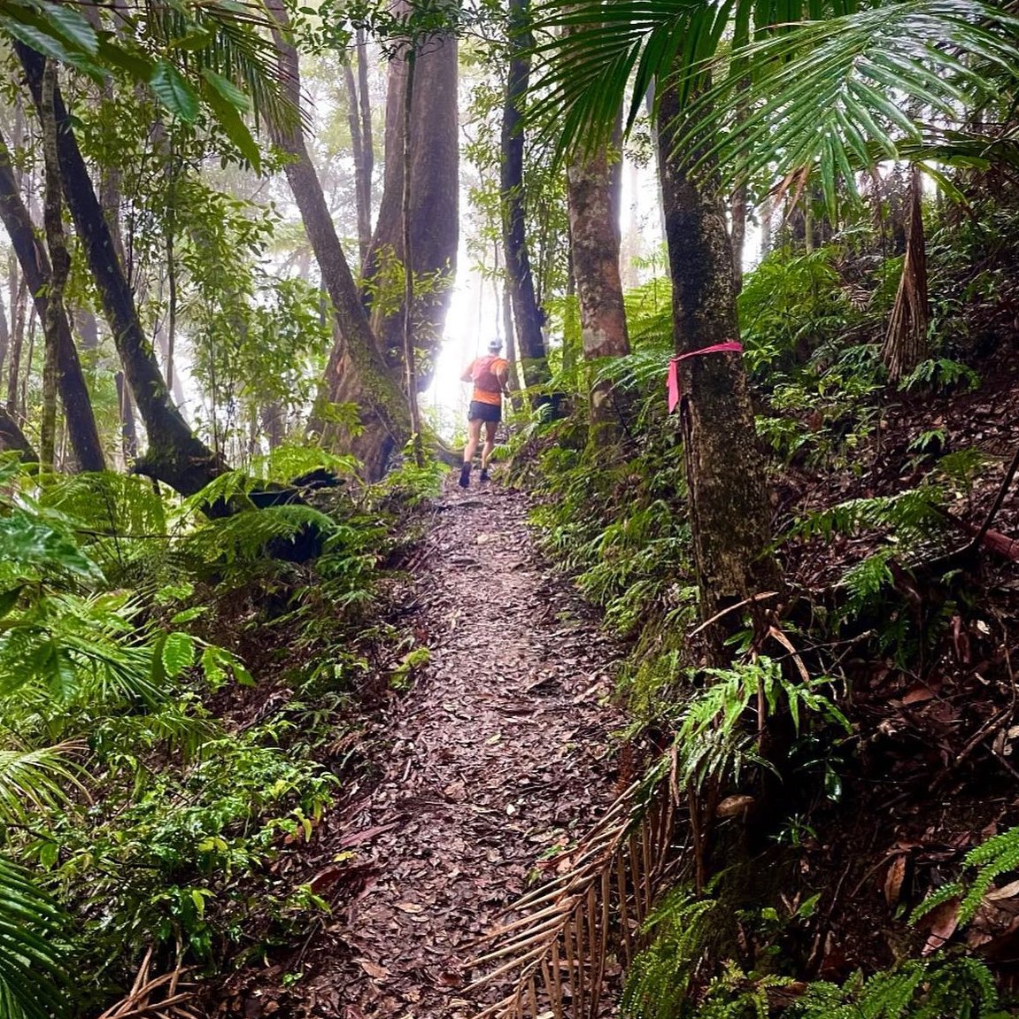
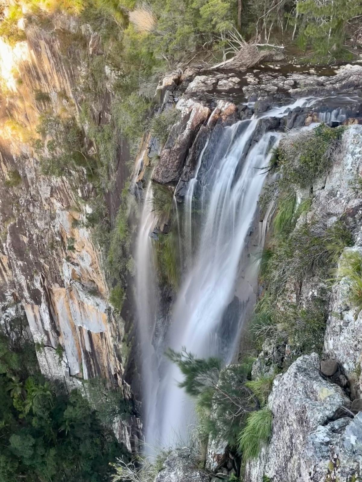
Experience the magic of Minyon
Come and run with Byron Bay Runners amongst World Heritage rainforest, on Saturday 21 June 2025, a treasured remnant of the ‘Big Scrub’, renowned for its diverse plant and animal life.
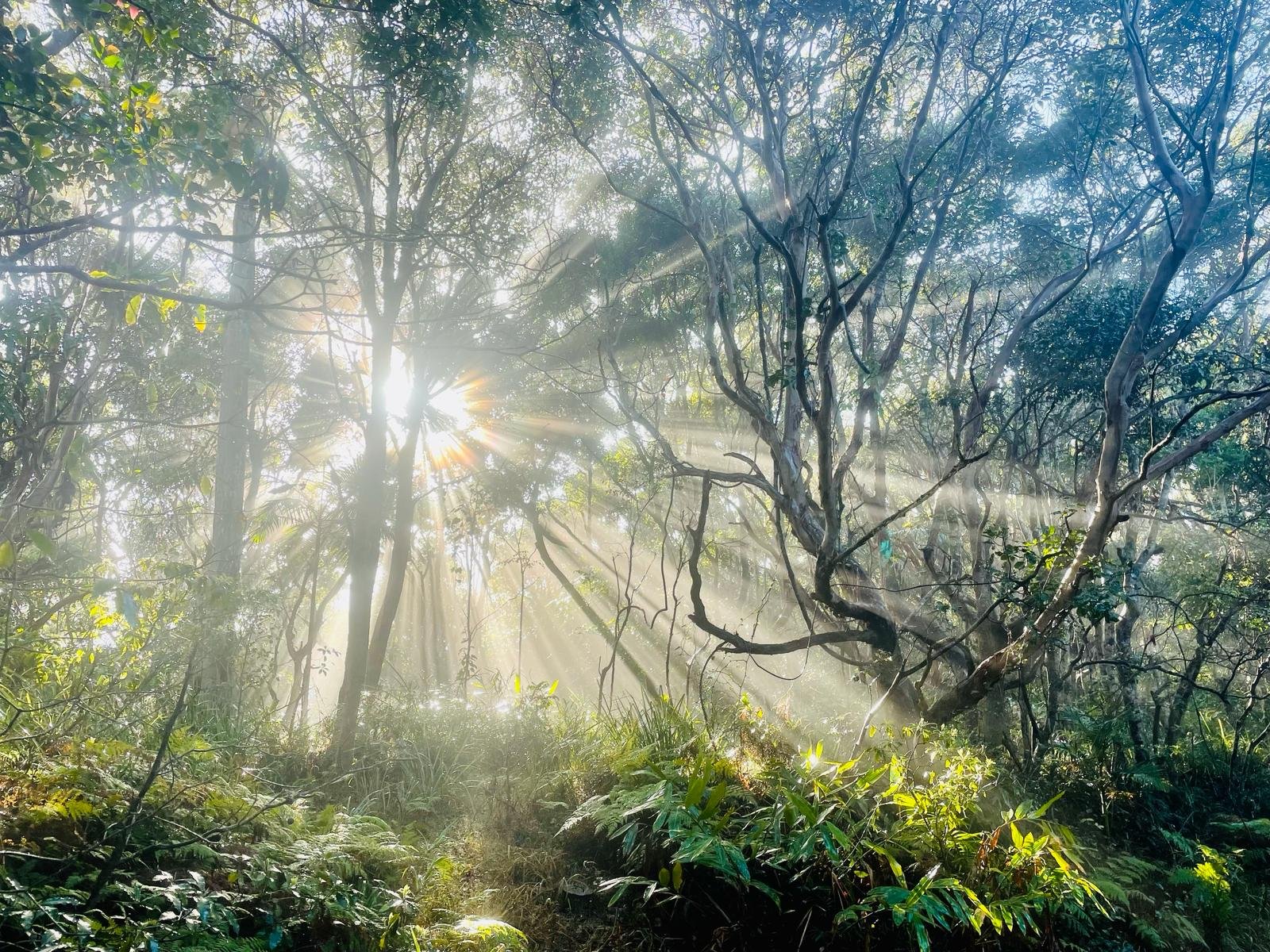
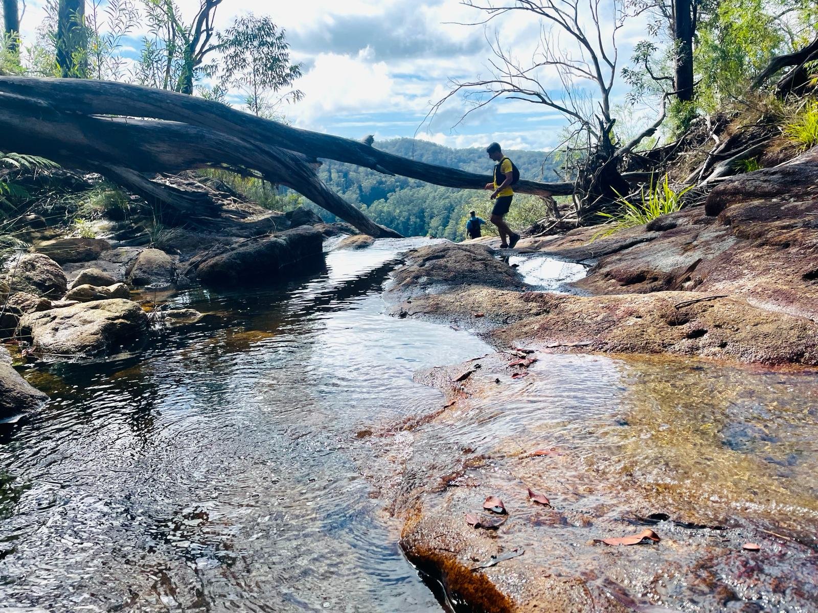
On the slopes of the caldera of the Wollumbin shield volcano, the Byron Rainforest Trail Run offers three race distances. Test yourself along a challenging mixture of single track and fire trails, with multiple water crossings and steep ascents. This local and easily accessible trail event will inspire you with spectacular views over Minyon Falls and the surrounding forests, and introduce you to the beauty of the Nightcap National Park.
Races start from:
6:30am for the Minyon Ultra 50km (minimum age 18yrs)
7:30am for the Postie’s Round 25km (minimum age 16yrs) SORRY SOLD OUT
8:30am for the Nightcap Nudge 12km (minimum age 14 yrs) SORRY SOLD OUT
This event is hosted by Byron Bay Runners club and has a strong focus on sustainability. As such it will be conducted as a leave-no-trace event.
Come, run, and experience this ancient, beautiful forest and surrounds.
Entries open now (close Wednesday 18 June at 5pm, field size limited to 150).
-
Nightcap Nudge 12km - SOLD OUT
A taste of Nightcap.
-
The Postie's Round 25km - SOLD OUT
It’s a long way between letter boxes.
-
Minyon Ultra 50km
This is the grand tour.
Nightcap Nudge 12km - SOLD OUT
The course broadly follows a figure 8 pattern with a challenging but enjoyable undulating start. This middle distance course then slips onto single track over waterways and through riparian rainforest, steadily spiralling up and around the side of Peates Mountain. With scenic views along the ridgeline giving an idea of what lies further up into the Park, it’s a full tilt rollercoaster back down to join the main fire trail, with some diversions onto flowing single tracks then along the Repentance Creek to the spectacular Minyon Falls.
Distance (actual): 14.49km Elevation: 575m
Ages: 14 up
Schedule: Registration from 6.00am, Race start 8.30am
Start and finish location: Event Hub — Minyon Falls Lookout
Aid stations: There will be aid stations at the event hub and every 6-8kms
Strava Route map, distance and elevation information
Mandatory Map Download:
You must have an offline map app installed on your phone (like Guru Maps)
Then click on this GPX Route link to download the map to your phone
Ensure that you are able to see the course you are running in the map app
Mandatory Gear:
Fully charged smart phone
Race Director’s contact on phone 0468 756 330
Snake bandage
Cost: $25 BBR members, $50 non-members
You must read the Participant Agreement before entering
Nightcap Nudge Course: 14.49km / 575m

Please email events@byronbayrunners.com to join the wait list.
The Postie’s Round 25km - SOLD OUT
It’s a long way between letter boxes, but believe it or not Historic Nightcap Track used to be the mail route between here and Nimbin. Of course it starts with some good hills, then turns onto some single track which climbs up and around Peate’s Mountain, all in search of more hills in the upper part of the Park. With some delicious detours to show off the diverse rainforest ecology and volcanic terrain, the trail rises to 800m before turning to head for home - with a long, fast and exciting 6km downhill sprint on graded fire trails hemmed by leggy eucalypts, and a final exhilarating push along the delightful Boggy Creek trail.
Distance (actual): 26.81 Elevation: 962m
Ages: 16 up
Schedule: Registration from 6.00am, Race start 7.30am
Start and finish location: Event Hub — Minyon Falls Lookout
Aid stations: There will be aid stations at the event hub and every 6-8kms
Strava Route map, distance and elevation information
Mandatory Map Download:
You must have an offline map app installed on your phone (like Guru Maps)
Then click on this GPX Route link to download the map to your phone
Ensure that you are able to see the course you are running in the map app
Mandatory Gear:
Fully charged mobile phone
Race Director’s contact on phone 0468 756 330
1L water
Snake bandage
Cost: $35 BBR members, $70 non-members
You must read the Participant Agreement before entering
Postie’s Round Course: 26.81km / 962m

Please email events@byronbayrunners.com to join the wait list.
Minyon Ultra 50km
This is the grand tour, with some sweeping loops up and down fire breaks, forestry roads and sections of single track. We tried to include everything - waterfalls, cliff top views, and beautiful diversity of terrain and rainforest. Initially following some of the shorter courses, then passing close by Minyon Falls and down the western wall of the Falls for some world-class scenery, and a brief visit to the base of the falls. Then a tour of some of the more remote areas of the park, with a long climb up to the highest point, joining again with the Postie’s Round course for some beautiful single-track trails. Then the course branches out in a loop along the escarpment overlooking Wanganui Gorge, with Goonengerry waterfalls in the distance. Then a nice little climb to discover your legs have abandoned you, but it’s all worth it with the highlight, a delightful track along Repentance Creek to the finish line.
Distance (actual): 52.15km Elevation: 2.052m
Ages: 18 up
Schedule: Registration from 6.00am, Race start 6.30am
Start and finish location: Event Hub — Minyon Falls Lookout
Aid stations: There will be aid stations at the event hub and every 6-8kms
Strava Route map, distance and elevation information
Mandatory Map Download:
You must have an offline map app installed on your phone (like Guru Maps)
Then click on this GPX Route link to download the map to your phone
Ensure that you are able to see the course you are running in the map app
Mandatory Gear:
Fully charged mobile phone
Race Director’s contact on phone 0468 756 330
1L water
Snake bandage
Headlamp (due to pre-dawn start)
Waterproof jacket
Space blanket
Thermal top
Cutoff time: 10 hours
Cost: $55 BBR members, $100 non-members
You must read the Participant Agreement before entering
Minyon Ultra Course: 52.15km / 2,052m

FAQs
-
Please join the Byron Rainforest Run Facebook Group for updates on the event.
-
Minyon Falls is approximately 45 minutes drive from Byron Bay, 40 minutes from Lismore, 2 hours from Brisbane, 1.5 hours from Southport, and 2.5 hours from Coffs Harbour.
-
Parking is very limited at the Minyon Falls event hub and Rummery Park campground. The total number of parking spaces is approximately 1 space per 2 competitors/spectators/event crew. There are no public transport options to the event and we ask that you carpool as much as possible. If you would like to carpool or need a lift, please reach out to other runners via the Byron Rainforest Run Facebook Group or contact us at events@byronbayrunners.com and we will try to help.
-
There is a limited amount of camping and parking at nearby Rummery Park (2km away) .
Byron Bay Runners have pre-booked a number of campsites there for Friday the 20th and Saturday 21st. We are happy to offer these to competitors and their families at no cost on a first-come-first-served basis. To reserve a camping spot, email us at events@byronbayrunners.com
-
A cancellation will be rolled over as an entry to next year's event.
We cannot accommodate person-to-person transfers.
Upgrades to longer distances will require an extra fee payment as follows:
• From 14.5km to 26.8km - $20
• From 14.5km to 52.1km - $50
• From 26.8km to 52.1km - $30Downgrades to a shorter distance are possible, however no refunds will be issued for the price difference between race distances. Please let us know at least 24 hours prior to the event.
Email us at: events@byronbayrunners.com
-
Yes, there are 6 toilets at the event hub at Minyon Falls lookout and 3 toilets at Rummery Park campground.
There are also 2 toilets available at the newly created campsites on the Gidjuum Gulganyi Walk which will be accessible from the 25km & 50km courses
-
Yes it will. Remember you don’t have to run the hills. Sometimes a fast hike is a better approach to get up a hill – leaving you with some energy to run once you’ve got to the top.
-
Highly likely. The course is in the rainforest and there may be some areas of the track that are boggy or wet. You can still run with wet shoes!
-
It is a trail run on uneven ground with some boggy parts, potentially slippery rocks and also slippery tree roots, etc. Trail running shoes with appropriate grip are recommended, however, you can run it with road runners but just be careful in the boggy/slippery parts.
-
Well possibly. It is a rainforest and there are known to be lots out there. The good news is they won’t kill you and can often be brushed off with a stick. Leech tip – wear white socks as they are easier to see and carry a small snap lock bag of salt – a little sprinkle and the leeches drop straight off (careful at mandatory drug testing though as a little snap lock back with white substance could look dodgy!)
-
it is a forest and there are lots of creatures out there. Two to keep in mind are snakes and ticks. The venomous snakes that you are most possible to come across are the red bellied black snake and the brown snake. In most cases these snakes would have sensed you thumping down the track before you arrive and will have been long gone. In the unlikely event that you get bitten stop all physical activity, apply pressure immobilisation snake bandage, sit or lie down and alert passing runners or officials and call triple zero (000).
Ticks are sneaky little buggers and can sometimes be mistaken for a mole. Usually a good idea to check yourself over (nooks, crannies and humid areas) after a run in the bush for ticks. You do need to be a little careful when removing ticks and a visit to the doctor/hospital can ensure that it is done correctly.
-
Yes. The 52.1km course will be marked with green fluoro tape, the 26.8km course will be marked with orange fluoro tape and the 14.5km course will be marked with red tape. The markings will be approximately every 300 to 400 metres. At intersections and decision points red and white tape across or on the side of a path will indicate where not to go and with appropriate arrows for the direction to go.
-
As mentioned above the course will be substantially marked. If you haven’t seen a marking for over 600 or 700 metres please back track until you again see a marker and then check your route. We will have sweeper runners for all distances who will come through after everyone else and you can wait and run with them if you feel disoriented. In the unlikely event that you do get lost please stay on the track or fire road, try your mobile phone (Ring Gary 0468 756 330 or Susan 0423 487 261). You can rest and stay put on the track/road and we will arrange a search party to find you.
-
Yes there will be rudimentary food and water aid stations for all distances, however, for the longer events (25km and 50km) please carry the mandatory water required and it is advised to carry some small snacks for yourself to keep your body fuelled.
-
We will endeavour to publish results and times within 48 hours. These will be published on the Byron Bay Runners website.
-
The Whian Whian State Conservation area and the Nightcap National Park does contain many cliffs and escarpments. The running trails largely avoid these, however, please remember many of these cliffs have unstable edges and slippery surfaces so please take care. Do not approach too close to the edge.
Event Contacts
If you don’t find your answer above please contact:
Race Director: 0468 756 330
Please join the Byron Rainforest Run Facebook Group for updates.